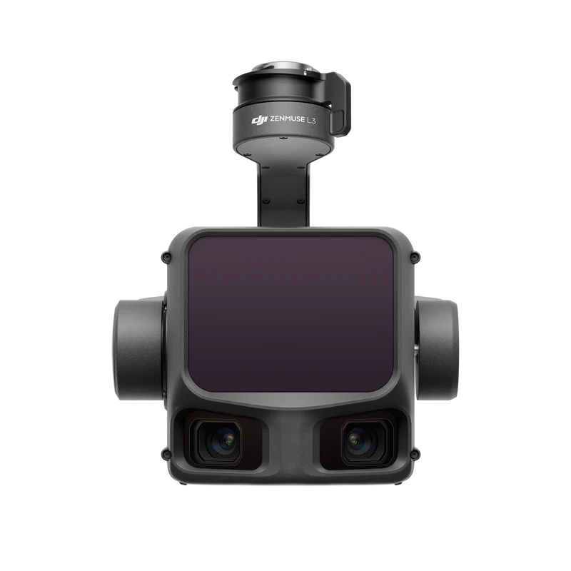
What is the DJI Zenmuse L3
The Zenmuse L3 is DJI’s next‑generation, high‑accuracy aerial LiDAR payload + mapping system — designed for professional survey, mapping, inspection, forestry, infrastructure analysis, and other geospatial applications.
It combines a 1535 nm long‑range LiDAR scanner with dual 100 MP RGB mapping cameras and a high‑precision POS (Positioning & Orientation System), integrated on a stabilized gimbal — giving a powerful all-in-one sensor module.
Key Specifications & Performance
| Spec / Feature | Detail / Performance |
|---|---|
| LiDAR Maximum Detection Range | Up to 950 m (on 10 % reflectivity target, at 100 kHz) (DJI) |
| Sampling / Pulse Rate | Adjustable between 100 kHz – 2 MHz, for flexible density / penetration trade‑offs. (Dronevex) |
| Returns per Pulse | Up to 16 returns (very useful for penetrating vegetation / complex surfaces — ground, canopy, structures). (Heliguy) |
| Accuracy (Point Cloud / Mapping) | ~ 3 cm vertical / 4 cm horizontal at ~120 m altitude; ~ 5 cm vertical / 7.5 cm horizontal at ~300 m. (store.hp-drones.com) |
| RGB Cameras | Dual 100 MP 4/3-inch mapping cameras (with mechanical shutter, pixel‑binning mode reduces to ~25 MP for faster ops / lower data heavy workflows) — useful for high‑resolution orthophotos + colorized point clouds. (gresco.com) |
| Gimbal / Integration | 3‑axis stabilized gimbal — LiDAR + cameras synchronized, ideal for drone-based aerial mapping; integrates with DJI software (e.g. mapping, post‑processing). (DJI) |
| Working Area / Efficiency | Capable of mapping large areas — up to ~100 km²/day under suitable workflows. (DJI) |


Reviews
There are no reviews yet.