Key Features
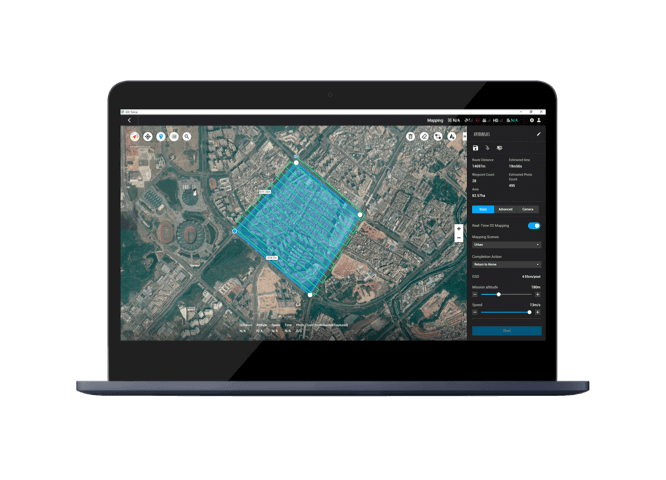
2D & 3D Mapping
Create high-precision 2D maps and 3D models using aerial imagery captured by DJI drones.
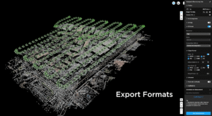
Photogrammetry Processing
Converts images into detailed point clouds, textured 3D models, and elevation maps.
Automated Mission Planning
Plan and automate flight paths for data capture with accuracy and consistency.
Real-Time Mapping
Generate instant 2D maps on-site for rapid decision making during missions.
Multi-Platform Data Export
Export models and maps into standard formats compatible with CAD, GIS, and other professional software.
User-Friendly Interface
Simple, intuitive design allowing surveyors, inspectors, and engineers to work efficiently.
What It’s Used For
Land Surveying & Topography
Ideal for creating detailed terrain maps in urban, rural, and construction environments.
Infrastructure Inspection
Bridges, roads, railways, power lines, and large industrial assets.
Construction & Site Planning
Volume measurements, earthwork analysis, and project progress tracking.


Reviews
There are no reviews yet.