

DJI MAVIC 3 ENTERPRISE SERIES
Your Everyday Commercial Drone
The Mavic 3 Enterprise Series redefines industry standards for small commercial drones. With a mechanical shutter, a 56× zoom camera, and an RTK module for centimeter-level precision, the Mavic 3E brings mapping and mission efficiency to new heights. A thermal version is available for firefighting, search and rescue, inspection, and night operations
Compact and Portable
4/3 CMOS Wide Camera [1]
56× Hybrid Zoom
640 × 512 px Thermal Camera [2]
45-min Max Flight Time [3]
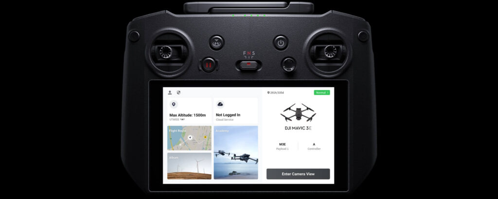
DJI O3 Enterprise Transmission
Centimeter-level Positioning with RTK [4]
High-Volume Loudspeaker [4]
Compact and Portable
Streamlined and compact, Mavic 3 Enterprise Series can be carried in one hand and deployed at a moment’s notice. Perfect for beginner and veteran pilots alike, it’s built to perform on lengthy missions.
Three Models, Countless Applications
DJI MAVIC 3E
Wide
4/3 CMOS, 20 MP, Mechanical Shutter
Tele
Equivalent Focal Length: 162mm, 12 MP, 56× Hybrid Zoom
DJI MAVIC 3T
Wide
Equivalent Focal Length: 24mm, 48 MP
Tele
Equivalent Focal Length: 162mm, 12 MP, 56× Hybrid Zoom
Thermal [2]
DFOV: 61°, Equivalent Focal Length: 40mm, Resolution 640 × 512
DJI MAVIC 3TA
Wide
Equivalent Focal Length: 24mm, 48 MP
Tele
Equivalent Focal Length: 162mm, 12 MP, 56× Hybrid Zoom
Thermal [2]
DFOV: 41.2°, Equivalent Focal Length: 60mm, Resolution 640 × 512
Premium Camera Performance
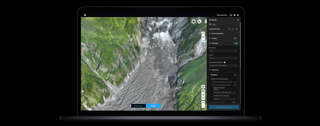
Survey with Speed
Mavic 3E’s wide-angle 4/3 CMOS, 20MP sensor has a mechanical shutter to prevent motion blur and supports rapid 0.7-second interval shooting. Complete mapping missions with extraordinary efficiency without the need for Ground Control Points.
Improved Low-Light Performance
Mavic 3E’s Wide camera has large 3.3μm pixels that, together with intelligent low-light mode, offer significantly improved performance in dim conditions
Focus and Find
Mavic 3E, Mavic 3T, and Mavic 3T Advanced are all equipped with a 12MP Tele Camera, supporting up to 56× Max Hybrid Zoom to see essential details from afar
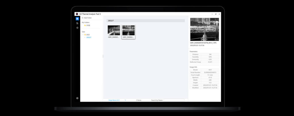
See the Unseen
Both Mavic 3T and Mavic 3T Advanced are equipped with a thermal camera with 640 × 512 resolution that supports point and area temperature measurement, high temperature alerts, color palettes, and isotherms to help you find your targets and make quick decisions.
Simultaneous Split-Screen Zoom
Mavic 3T and Mavic 3T Advanced’s thermal and zoom cameras support 28× continuous side-by-side zoom for easy comparisons.
Exceptional Operational Efficiency
Batteries Optimized For Endurance
45-min flight durations let you cover more ground each mission, for surveying of up to 2 square kilometers in a single flight. [3][5
45 Minutes
Max Flight Time
Surverying Area in a Single Flight
4/3 CMOS, 20 MP, Mechanical Shutter
Fast charge batteries with 100W charging hub, or directly charge the drone with 88W fast charging.
100W
Charging Hub
88W
Aircraft
Next-Generation Image Transmission
Four built-in antennas support O3 Enterprise Transmission, with two antennas to transmit signals and four antennas to receive signals. The aircraft and remote controller both support the DJI Cellular Dongle.* This enables 4G Enhanced Transmission to work with O3 Enterprise Transmission for seamless operation in complex environments, helping to ensure safer flights
Omnidirectional Sensing for Safe Flying
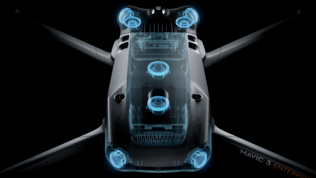
Equipped with wide-angle lenses on all sides for omnidirectional obstacle avoidance with zero blind spots. Adjust proximity alarms and braking distance depending on mission requirements. [6]
Advanced RTH automatically plans the optimal route home, saving power, time, and hassle
APAS 5.0 enables automatic rerouting around obstacles, so you can fly with peace of mind. [7]
Flight Route
Real-Time Terrain Follow
Smart Oblique Capture
Live Mission Recording
Corridor Mission Planning
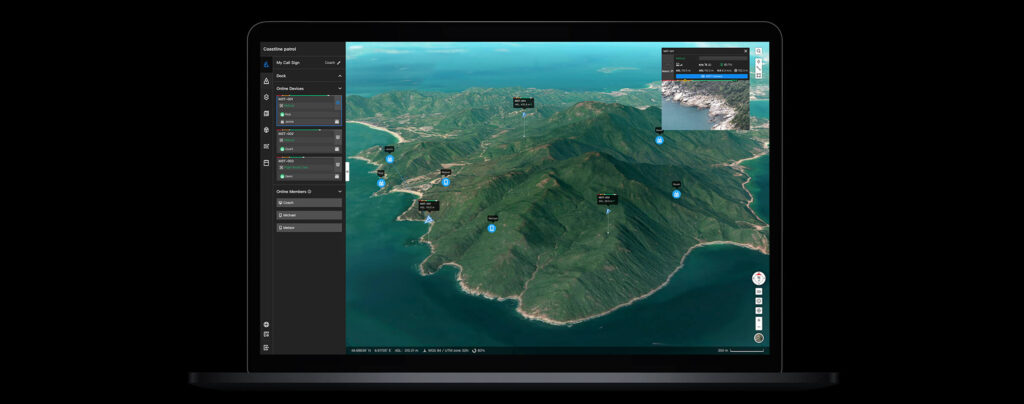
Full Software Suite
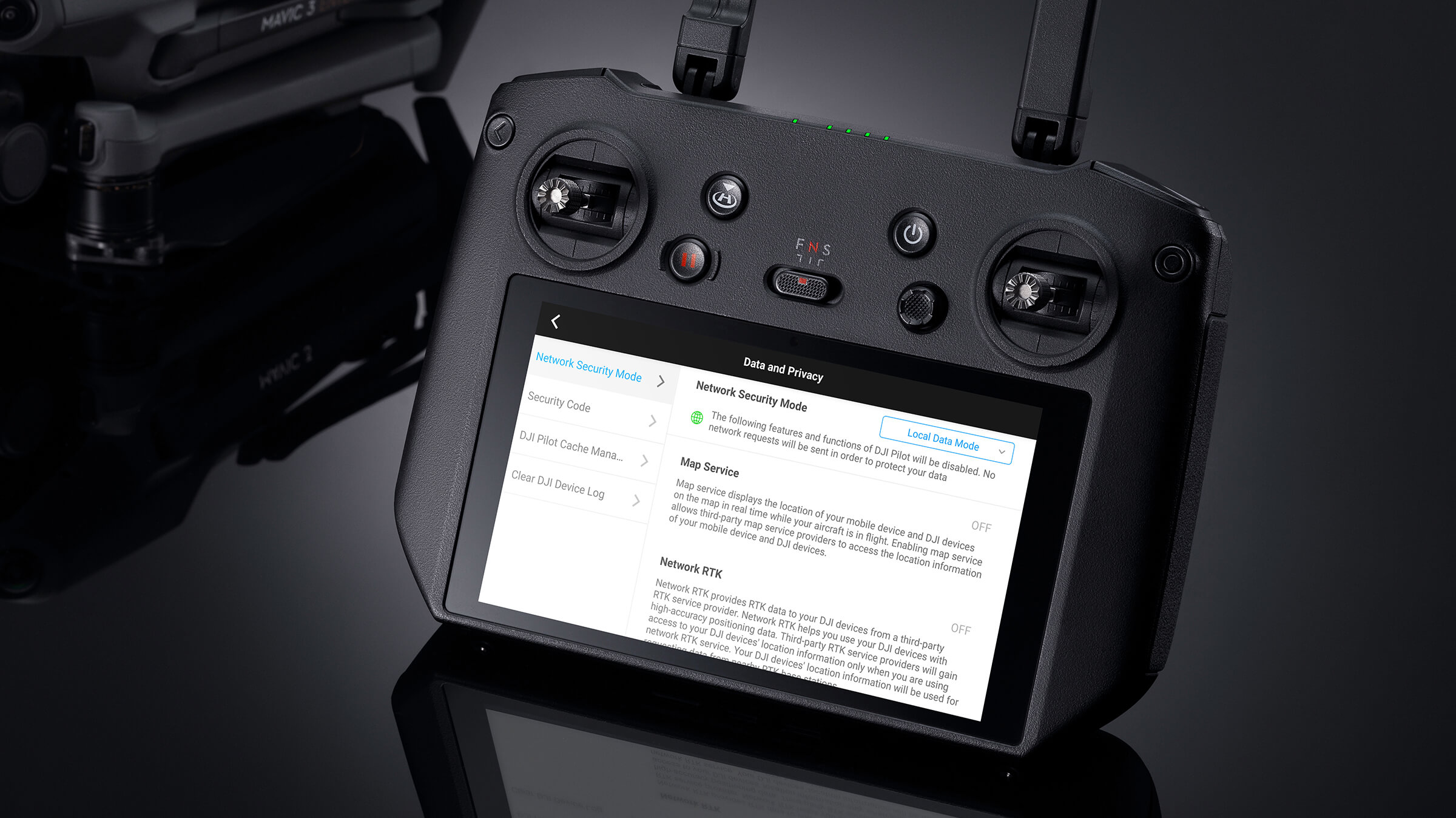
User Data Security