

Flagship Intelligent Multi-Sensor Compact Drone
MATRICE 4 Series
The Age of Intelligent Flight
Introducing the DJI Matrice 4 Series, a new compact and intelligent multi-sensor flagship drone series for enterprise industries. The series includes Matrice 4T and Matrice 4E, each equipped with advanced features such as smart detection and measurement with laser range finder. Flight operations are now safer and more reliable with significantly enhanced sensing capabilities. The accessories for the Matrice 4 series have also been significantly upgraded. The Matrice 4T is suitable for a wide range of industries, including electricity, emergency response, public safety, and forestry conservation. The Matrice 4E is designed for geospatial applications such as surveying and mapping, construction, and mining. A new era in intelligent aerial operations begins now.
Two Models, Countless Applications
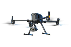
DJI MATRICE 4T
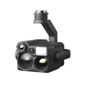
Wide-Angle Camera
1/1.3″ CMOS, 48MP Effective Pixels, f/1.7, Format Equivalent: 24 mm
Medium Tele Camera
1/1.3″ CMOS, 48MP Effective Pixels, f/2.8, Format Equivalent: 70 mm
Tele Camera
1/1.5″ CMOS, 48MP Effective Pixels, f/2.8, Format Equivalent: 168 mm
Laser Range Finder
Measurement Range: 1800 m (1 Hz); Oblique Incidence Range (1:5 Oblique Distance): 600 m (1 Hz) Blind Zone: 1 m; Range Accuracy (m): ± (0.2 + 0.0015 × D) [1]
Infrared Thermal Camera [2]
Resolution 640 × 512, f/1.0, Equivalent Focal Length: 53 mm, Uncooled VOx Microbolometer, Supports High-Res Mode
NIR Auxiliary Light [3]
FOV: 6°, Illumination Distance: 100 m
DJI MATRICE 4E
Wide-Angle Camera
4/3 CMOS, 20MP Effective Pixels , f/2.8-f/11, Format Equivalent: 24 mm, Mechanical Shutter
Medium Tele Camera
1/1.3″ CMOS, 48MP Effective Pixels, f/2.8, Format Equivalent: 70 mm
Tele Camera
1/1.5″ CMOS, 48MP Effective Pixels, f/2.8, Format Equivalent: 168 mm
Laser Range Finder
Measurement Range: 1800 m (1 Hz); Oblique Incidence Range (1:5 Oblique Distance): 600 m (1 Hz) Blind Zone: 1 m; Range Accuracy (m): ± (0.2 + 0.0015 × D) [1]
Intelligent Operations
Smarter Operations
The built-in model can detect vehicles, vessels, and subjects during search and rescue operations or routine flights. It also supports switching to other models, enabling the expansion of application scenarios. Additionally, it supports high-res grid photos and features powerful tracking capabilities
Laser Range Finder, Precise Measurement
The laser range finder enables real-time precise measurement. Through simple operations such as pin point, line drawing, and area calculation, it can complete tasks like marking target locations for inspection purposes or calculating the area of a wildfire. Additionally, users can share info via the DJI Pilot QR code or FlightHub 2 with relevant personnel to enhance collaboration and workflow efficiency.
Observation Range Recording
DJI Pilot 2 can highlight the center position of the camera frame and ground area observed. It can display the surveyed area on the map, making it especially useful for patrols, and rescue operations in mountainous terrain without clear landmarks
Efficient Flight, Intelligent Operations
Excel In Low-Light Environments
Night Scene Mode
Smart Low-Light Photo
NIR Auxiliary Light
Thermal Imaging
Low-Light Fisheye Omnidirectional Sensing[5]
Crystal Clear Vision: Unveil the Details
Capture Every Detail at A Distance
Enhanced Medium Telephoto
The Matrice 4 series is equipped with a medium tele camera, expanding its capabilities for medium-range inspection tasks. During power line or bridge inspections, it can detect screws and cracks from a distance of 10 meters and clearly read instrument data at substations. [6]
Foreground Stabilization for Telephoto Imagery
The upgraded telephoto stabilization makes foreground subjects stable and clear during telephoto shooting at 10x zoom or higher. In scenarios such as public safety and inspections, subject details are clearly visible.
Super Resolution Telephoto
The tele camera of the Matrice 4 series has significantly improved clarity, featuring 48 MP resolution, capable of capturing incredibly details from signs up to 250 meters away. [7] Additionally, the Matrice 4T is equipped with an IR-Cut Filter, ensuring 24/7 operations
Electronic Dehazing, Clear as Ever
In conditions such as smog or atmospheric humidity, Electronic Dehazing supports three modes (Low, Medium, High) to improve the imaging clarity of the Matrice 4 series to match different operational environments and requirements
Precision Mapping, Time-Saving and Effortless
Rapid 0.5-Second
Interval Shooting
The Matrice 4E wide-angle camera supports rapid 0.5-second interval shooting in both orthophoto and oblique photography modes, enabling high-speed aerial surveying from multiple angles. Additionally, the mapping flight speed can reach up to 21 meters per second, [8] significantly enhancing work efficiency
Multi-Directional Capture, Efficiency Multiplied
5-Directional Oblique Capture
The Matrice 4 series supports a new 5-directional oblique capture. The gimbal can intelligently rotate and shoot at multiple angles based on the survey area, achieving the effect of multiple shots in a single flight compared to previous models, [9] significantly enhancing the efficiency of small drone oblique photography
3-Directional Ortho Capture [10]
Matrice 4E supports 3-directional ortho capture, enabling lateral capturing while performing ortho collection tasks, which reduces lateral overlap. A single flight can complete mapping operations for an area of 2.8 square kilometers. [11] No additional elevation optimization flight route is required to achieve better elevation accuracy. Combined with new DJI Terra capabilities, it further enhances reconstruction efficiency while ensuring quality
Smart 3D Capture, Precision Modeling
DJI Matrice 4E supports Smart 3D Capture, which allows you to capture and create a rough model on the remote controller. Based on the rough model, it can quickly generate precise mapping routes close to a structures surface, completing detailed measurements and modeling of irregular buildings. It also supports displaying virtual space routes and waypoint photos for smart 3D capture, making it convenient to assess specific routes’ flight safety and coverage area
Smart 3D Explore for Modeling
Matrice 4E can be paired with Manifold 3 to enable Smart 3D Explore for modeling. Leveraging Manifold 3’s robust computing power, the system automatically plans safe flight routes within the object’s environment and generates a rough 3D model that can be viewed in real time on the remote controller. This streamlines the close-range photogrammetry workflow and improves efficiency
New Dual-Battery System
The Matrice 350 RTK is equipped with a new TB65 dual-battery system, which supports battery hot swapping and allows for multiple flights without powering off. The battery can be charged up to 400 cycles, [3] reducing the cost of a single flight.
Distortion Correction, Precision Enhancement
Auto-Generated Surveying Operation Report
Safe Flight, Worry-Free Operation
Fusion Positioning, Safe Return-to-Home
The Matrice 4 series comes with an integrated DJI RTK module which supports the extended L5 frequency band and features GNSS+Vision Fusion Positioning and Navigation System. It allows for the return-to-home point to be updated through visual positioning, allowing for rapid takeoff within 15 seconds. Even without GNSS signals, it can complete the return-to-home process, effectively overcoming signal obstructions and interference commonly found in urban environments
Intelligent Guidance, Unobstructed Flight
When the DJI RC Plus 2 Enterprise remote controller is connected to the internet, it can load terrain elevation maps and preload detailed maps. This enables automatic path planning for obstacle avoidance, effectively managing scenarios such as flying at night or through mountainous areas, ensuring the safety of flight operations. The drone has a 5-directional vision assist view system along with downward vision, which aids in providing comprehensive visibility for enhanced protection
Achieve New Heights in Video Transmission
The O4 Enterprise video transmission system sets a new industry standard for challenging environments. Thanks to the 8-antenna system in the Matrice 4 Series and the high-gain antenna in the remote controller, you can achieve up to 25 kilometers in transmission range. [13] Furthermore, the system improves image transmission with a download bandwidth of 20MB/s, more than double the bitrate of the Mavic 3 Enterprise Series, ensuring more precise and stable images of route uploads and material downloads. [13]
The Matrice 4 series supports an optional DJI Cellular Dongle 2. [14] By utilizing 4G image transmission in conjunction with the aircraft’s antennas, signal stability is further enhanced
Accessory Upgrades, Performance Leap [15]
Gimbal-Following Spotlight
The DJI AL1 SpotLight can illuminate subjects up to 100 meters away, [16] and features two modes, Always-On and Strobe. It can connect with the gimbal, enabling it to follow the camera’s movements to ensure the illuminated area aligns with the camera’s view. Additionally, the spotlights can focus on a single object or offer a wide field of view (FOV) which illuminates up larger areas
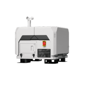
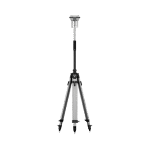
High-Precision D-RTK 3 Multifunctional Station
The D-RTK 3 Multifunctional Station can serve as a base station to provide centimeter-level positioning for multiple drones simultaneously or extend the operational range of drones in relay station mode*. Additionally, the new Rover Station Mode, combined with the DJI Enterprise app and DJI Terra, provides a comprehensive solution for high-precision aerial surveying applications, ensuring a secure and accurate operation.
Software Designed for Industries
DJI Pilot 2
DJI Pilot 2 interface has been comprehensively updated, featuring a customizable intelligent function toolbar and support for various types of flight routes. Additionally, it includes virtual space models and route preview functions, [22] making operations more convenient and efficient. It can connect with FlightHub 2 to enhance drone control operations and facilitate cloud information sharing, therefor reducing the workload of frontline pilots
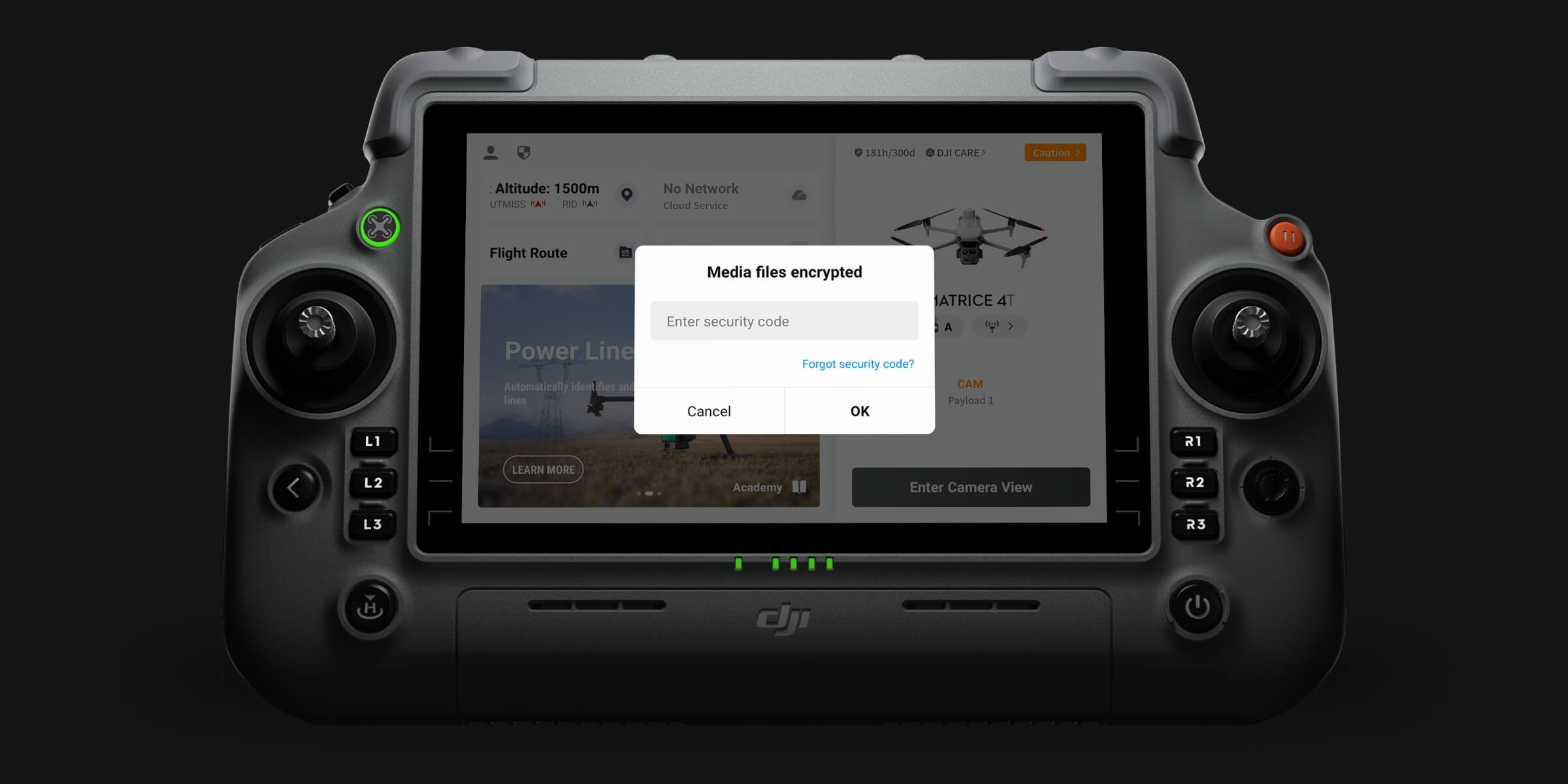
User Data Security