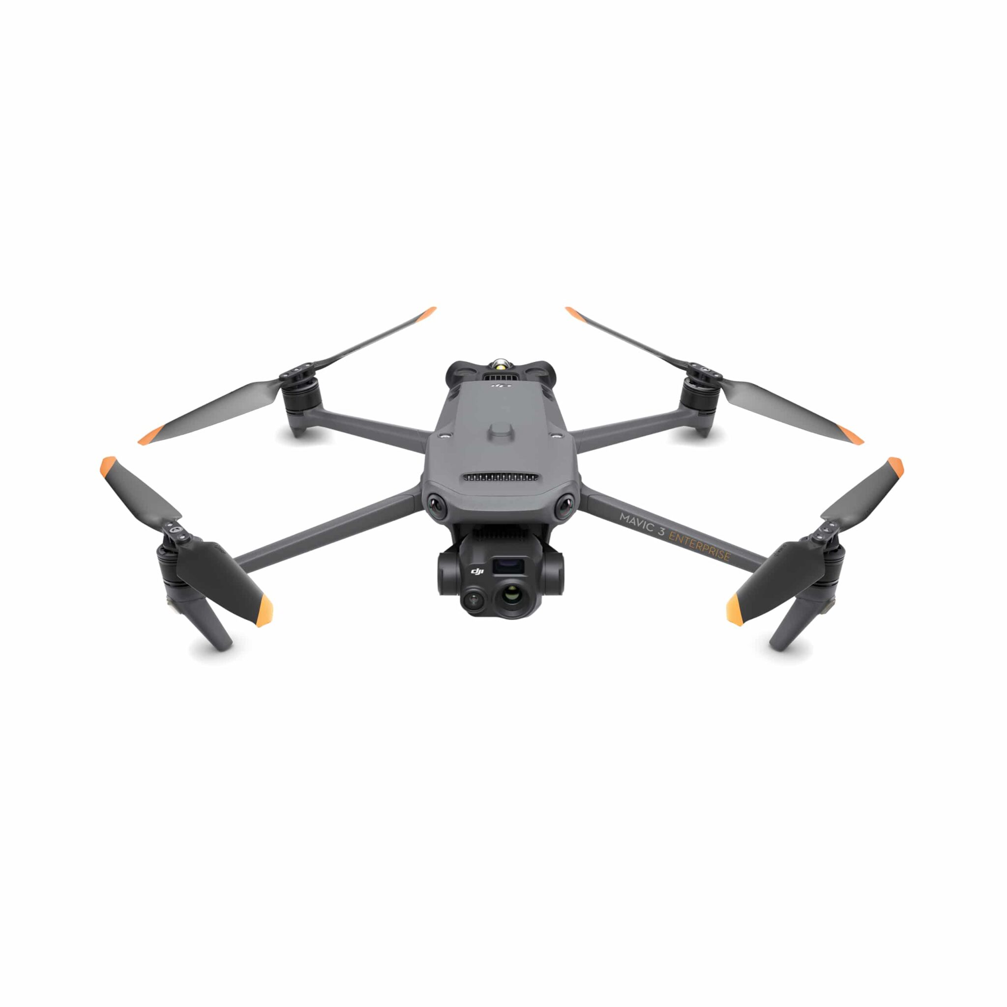
What is Mavic 3 Enterprise
The Mavic 3 Enterprise series is DJI’s compact commercial drone line — built to bring enterprise-level drone capabilities in a relatively small, portable package.
It combines a high-performance camera system, optional thermal sensor, precise positioning (RTK), and long-range stable transmission for professional missions — from surveying and mapping to inspection, public safety, and emergency response.
Camera / Sensor & Imaging Capabilities
Wide camera: 4/3″ CMOS sensor, 20 MP, with a mechanical shutter — good for accurate mapping and high-quality photos.
Tele / Zoom camera: combined with wide lens, it offers up to 56× hybrid zoom. Useful when you need to “get close” to a subject without flying near.
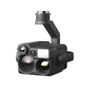
Thermal version (Mavic 3T / 3TA): offers a 640 × 512 px thermal camera (with 61° field of view, 40 mm equivalent focal length) to enable temperature measurement, hotspot detection, night missions, inspections (e.g. infrastructure, power lines), or search-and-rescue ops.
Allows split-screen zoom + thermal view (on thermal model), so you can simultaneously monitor visual + thermal info when needed.
Because of the mechanical shutter + 4/3″ sensor + zoom + optional thermal, Mavic 3 Enterprise is flexible: good for mapping, inspection, surveying, and many professional tasks.
Flight Performance, Transmission & Safety
Flight time: up to 45 minutes per battery.
Portable & Foldable: light weight and compact size — easy to carry and deploy quickly when needed.
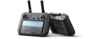
Transmission / Range: Uses DJI O3 Enterprise Transmission, giving a stable live feed and remote-control link. Under ideal conditions, the remote controller can remain connected up to ~15 km (unobstructed, no interference).
Omnidirectional obstacle avoidance & sensing: the drone has sensors on all sides, helping avoid collisions — useful especially in complex environments (urban, near structures, low altitude).
Smart flight support & mission tools: The Mavic 3 Enterprise supports automated mission workflows — like flight planning, corridor missions, terrain-follow (i.e. adjusting height to ground elevation), smart oblique capture for 3D modeling, corridor inspection missions etc. This helps make surveying/inspection tasks more efficient and repeatable.


Reviews
There are no reviews yet.